Ordnance Survey is the national mapping agency for Great Britain. They help the UK government make smarter decisions that ensure safety and security. Additionally, they show businesses how to gain a location data edge. Lastly, they help everyone experience the benefits of the world outside.
Ordnance Survey Project Description
Ordnance Survey were in the process of replacing their SAP ERP system that is 20 years old and no longer fit for Ordnance Survey’s current operations. A plan was developed for the best approach to replace SAP with the proposed SaaS-based ERP solution provided by Microsoft Dynamics. CoderTalent was brought in to develop the new web app from scratch for the Digital Business Admin Panel (DBAP).
Tech Stack Used
The DBAP web app was written entirely in ReactJS, an open-source Javascript library. React strives to provide speed, simplicity and scalability. Some of its most notable features are Reusable components, Stateful components, Virtual Document Object Model.
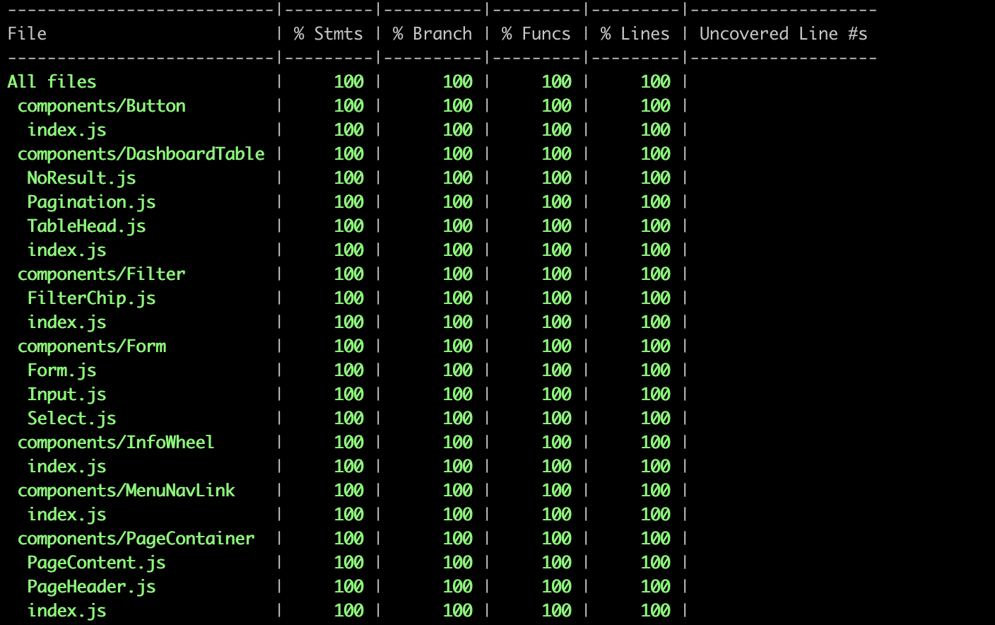
The CoderTalent team used React Hooks, the latest new feature that comes with React for application state management. We chose to use Hooks because it brings many benefits to React functional components. These components that have the ability to share logic across components. The Team also developed a shared common library that maintained all the common code in one repository. It can also be re-used for future projects and having unit tests with average test coverage of 100%.
The complete tech stack used for the project was:
- Azure DevOps configured the entire web app CI/CD pipeline
- OData as the API tech of choice
- Azure Key Vault for storage of relevant keys & secrets
- Oauth 2.0 for authentication
- Azure Active Directory for initial authentication to web app
- Jest/Enzyme for unit tests
- GitFlow Workflow
Results
Developing the UI from scratch, the business received a complete digital transformation that improved the overall business operations at Ordnance Survey.